12 Michael Dr Rutland, MA 01543
Property details
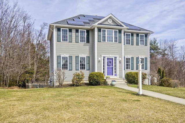
About 12 Michael Dr
This beautifully maintained Colonial features an open concept floor plan and stunning hardwood flooring throughout the main level. The spacious family room is flooded with natural light creating a warm atmosphere.The kitchen boasts an oversized breakfast bar, recessed lighting, ample cabinetry and slider leading to an elevated back deck. Formal dining room, adjacent to the kitchen is ideal for gatherings. Convenient half bath with washer/dryer and pantry closets complete the main level. Upstairs, enjoy 2 generously sized bedrooms, full main bath, versatile bonus room for home office, nursery, or playroom and primary with walk-in closet and private bath.The finished basement with private entrance, half bath and access to garage provides additional living space or option for home business or gym. Outdoors, the home sits on a sprawling lot with mature landscaping lining the backyard. Relax on the deck overlooking the peaceful lot with separate fenced-in area for fire pit, playset or pets!
Highlights
(Contingent)
Summary
- MLS Number: 73358056
- MLS Name: MLS Property Information Network
- Office Name: Real Broker MA, LLC
- Office Phone: (855) 450-0442
- Listing Agent: The Liberty Group
 Disclaimer: The property listing data and information set forth herein were provided to MLS Property Information Network, Inc. from third party sources, including sellers, lessors and public records, and were compiled by MLS Property Information Network, Inc. The property listing data and information are for the personal, non commercial use of consumers having a good faith interest in purchasing or leasing listed properties of the type displayed to them and may not be used for any purpose other than to identify prospective properties which such consumers may have a good faith interest in purchasing or leasing. MLS Property Information Network, Inc. and its subscribers disclaim any and all representations and warranties as to the accuracy of the property listing data and information set forth herein. We may make use of information provided by users of this website - see our Terms of Use for more details on our privacy policy.
Data displayed may be a portion of, and not a complete set of all listings published in the MLS.
Last updated on: 4/22/2025, 2:20:50 PM Eastern. If you have any questions regarding the accuracy of this data, please contact us at help@rockethomes.com.
Get an agent. Get a mortgage. Save big.¹
$574,900
12 Michael Dr
$6,827
closing credit¹
Sell your home with Rocket and save even more!
Seller rebate
0.5% sale price²
Price information
Property sales
| Date | Event | Price |
|---|---|---|
| Dec 22, 2017 | Home Sold | $339,900 |
Tax history
| Year | Assessment | Property Tax |
|---|---|---|
| 2024 | $439,500 | $6,518 |
| 2023 | $430,900 | $5,912 |
| 2022 | $350,400 | $5,533 |
| 2021 | $333,300 | $5,566 |
| 2020 | $335,000 | $5,899 |
| 2019 | $324,000 | $5,796 |
History based on county public records data.
Nearby schools
6
Glenwood Elementary School
Public District 3-5
1.4 mi
•65 Glenwood Rd
6
Davis Hill Elementary
Public District KG-5
4.5 mi
•78 Jamieson Rd
6
Dawson Elementary School
Public District KG-5
5.8 mi
•155 Salisbury St
School ratings are a score out of 10, where 10 is the highest and 1 is the lowest.
Neighborhood
The neighbors living near this home have an average income of $94,269. Residents of Rutland, MA typically earn between $35k-100k each year. Most families are married, with kids. Residents of this area typically have post secondary degree education.
How much money do the neighbors make?
What level of education do the neighbors have?
What types of families live nearby?
Are the neighbors home owners or renters?
How old are people in this area?
What do the neighbors do for fun?
 Hunting
 Figure Skating
 NASCAR
Where do the neighbors shop?
 Dick's Sporting Goods
 Dillards
 Dollar General
Where do the neighbors go to eat?
 Texas Roadhouse
 Cracker Barrel
 Applebees
What do the neighbors drive?
 Subaru
 Cadillac
 Ram
Ram
What do the neighbors listen to?
 New Country
 News/Talk/Information
 Classic Country
Frequently asked questions
About 12 Michael Dr
This home is located at 12 Michael Dr in Rutland, MA and zip code 01543. This 2,000 square foot home, which was built in 2013, sits on a 2.04 acre lot. Features: 3 bedrooms, 4 bathrooms. It has been listed on Rocket Homes since April 10, 2025 and is currently priced at $574,900.
Rutland, MA housing market in March 2025 saw over 0 listings sold above listed price, more than 0 sold at listed price and over 2 sold below. In March 2025 in Rutland, MA there were 21.7% less homes for sale than in February. In March 2025, listings were on the market for 13 days. During the same period, the median list price in this real estate market was $500,950.